|
1 Comment
 On May 21, 2007, we opened our doors at our 1100 sq. ft. office/warehouse space on Gold Rush Drive in Lexington, Kentucky.
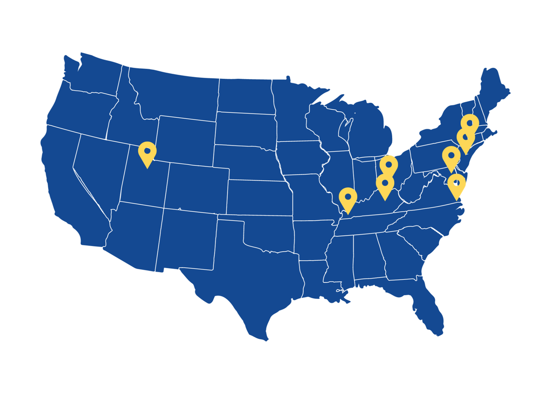
Ten years ago, our Vice President Don Wilkins went to work at the new office for the very first time while our President Amy Wilkins was working on getting things set up from home (and juggling a 1 and 2 year old and puppy). Later that morning, we received a call from Stantec - it was our lucky day! Someone had managed to get their house boat stuck on Dam 4 and we were being called in to assist in the recovery effort which ended up paying $919.50. We were thrilled to be off to such a great start! While there has been many ups and downs since that first day, we would like to take a minute and look at where we are today. We have locations in Nicholasville, KY; Rosedale, MD; Newark, NJ; and New York, NY with over 50 employees. Our staff's dedication to providing exceptional quality of service while always maintaining safety has been key to our success. We would not be here without all of their hard work, long hours, and commitment to safety and excellence. We would like to thank our employees, clients, and community for your dedication and loyalty to Marine Solutions - it is greatly appreciated. We look forward to what we can accomplish together in the next 10 years! 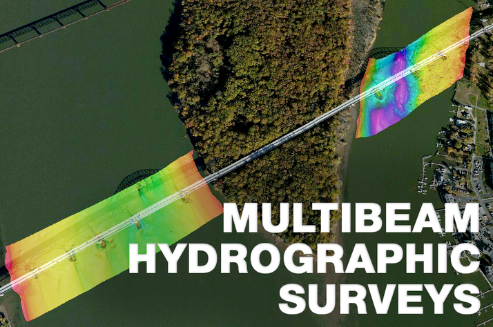 Need a hydrographic survey? Does a structure have a scour problem? Do you need dredge quantities? Would you like a 3D model of a submerged structure? If your answer is "yes" to any of these questions we can help with our multibeam sonar! Multibeam surveys offer considerable advantages over traditional single beam surveys. Instead of running intermittent lines with a single sonar beam and interpolating depths between the lines, multibeams use a swath of hundreds of beams to provide “100 percent” coverage of the seafloor. This provides for identification and visualization of underwater objects, hazards to navigations and other features. Marine Solutions owns and operates a high resolution mutibeam sonar. Our sonar is coupled with an Applanix POS MV providing accurate attitude, heading, heave, position, and velocity data, using the latest Inertially-Aided Real-Time Kinematic (IARTK)/GPS technology. Additionally, positioning data is post processed using observations from the CORS Network to provide the most accurate positioning information available. Marine Solutions is using a variety of collection and processing software packages to gather and process survey data. The software used can provide the data in all common formats that a client may desire and provides interactive models of survey data that can be viewed using free software. Some features of our system include:
|
|
© 2010-2024 Marine Solutions, Inc.
|
AFFILIATES
|